Drone Services
Big Pine Consultants LLC is always working to innovate and use the latest technology to support our clients needs. Drones are a fast evolving technology that can streamline the planning and management of your projects in an affordable and fast way. Below are some examples of what Big Pine can do for you, starting with a 3D model comparison of a mine reclamation site in southwest Pennsylvania for Titan Energy Solutions. First, explore the web app we created below of the site from two different flights on September 25, 2020 and October 21, 2020 respectively. The frames are synchronized so that you are always seeing both dates from the same perspective. Then we will describe how we did it, how long it took to create, and what we can do with the information.
Ground Control Points
The above comparison is visually immersive, but how accurate is it and what can we do with the information it provides? Accuracy of the 3D model or mesh is dependent on the accuracy of ground control points (GCPs) used to process the imagery. In the case above, Big Pine used a Trimble GeoXH 6000 GPS unit with a Tornado antenna mounted on a 2m range pole with a bipod. Five or six GCPs were used on each date. The GCPs were set using 8” Mag Hubs marked with black and white aerial targets and were spread out around the edges of the site, in areas not obscured by overhead trees or structures, and making sure a GCP was at the low and high points of the site.
Approximately 150 GPS positions were collected for each GCP.
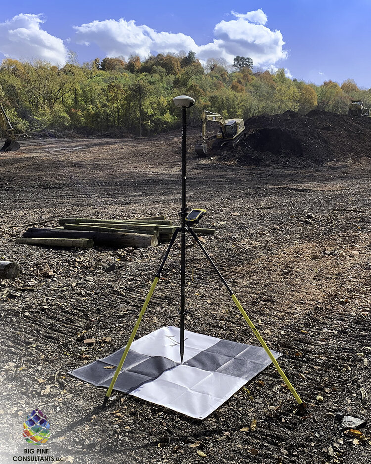
The locations were differentially corrected in the office using Trimble Pathfinder Office software and the resulting corrected precision was mostly <30cm (sub-foot). A licensed surveyor can provide improved accuracy using a sub-centimeter capable GPS receiver that uses a GNSS service, which would be required if the imagery is to be used for engineering, survey, or legal purposes.* For general information, inspection, and management purposes, this level of ground control is typically sufficient. It aligns well with publicly available aerial imagery and ground elevation data required to create things like the 3D scenes used in the comparison above. See if you can find the GCPs in the model above!
Flight Planning
After setting GCPs, we conducted flight planning using the Site Scan light edition app on an iPad Mini attached to the controller of our DJI Phantom 4 Pro V2.0 drone. The flights were taken at different altitudes for each date, 200 feet in September and 250 feet in October. Flying at higher altitudes increases coverage of each image taken which speeds up the flight, reduces the overall number of images required, and requires somewhat fewer GCPs since they will be visible in more images. The downside of flying at higher altitudes is reduced resolution of the collected imagery. The post-processing in photogrammetry software is also a consideration to keep in mind when planning your flight. More images take more time to process. Altitudes should be flown that meet the needs of the project, while minimizing the overall number of images and GCPs needed to cover the area of interest. Because it takes more time, if higher resolution is required, it will typically be more expensive. Even when flown at 400-feet, the image resolution from a drone will typically be similar to or better than the highest publicly available resolution. To improve coverage of the resulting photogrammetry, we increased the overlap of images in Site Scan from the default to 80% vertical and 80% horizontal overlap. This also resulted in more images being taken and the resulting post-processing time increased, but it also improved the resulting elevations produced later with photogrammetry software. When planning a flight, it is also important to keep in mind elevation changes. You must plan to fly at an altitude that avoids conflicts with the tallest object in your flight path.
Typically, flight planning can be done on-site immediately before your flight, but the remote pilot in command must complete due diligence before going to the site as well. Specifically, the remote pilot should verify that the flight will not be in conflict with airspace restrictions such as but not limited to controlled airspace near an airport, restricted airspace, prohibited airspace, military operating areas, other special use areas, or areas that have an active Notice to Airmen (NOTAM). The remote pilot should also consult the navigational chart for the flight location for potential hazards such as communications towers, military training routs (MTR), visual checkpoints, helicopter landing pads, nearby airports, and other potential hazards.
The Flight
Next, we completed the flight. This was the easy part. Today’s GPS enabled drones will fly the planned flight path and take the required images all by themselves. As the remote pilot, our job is to observe the surroundings of the drone and make sure there are no conflicts. If a hazard is identified, the remote pilot must be prepared to take the controls to avoid collisions.
For most drones, flights (and the areas they can cover) are typically limited by the battery power of the drone. Most commercially available multirotor style drones that rely on battery power alone get between 25 minutes and 60 minutes of flight time. Some drones have hybrid gas/electric power that allow for multiple hours of flight. Some fixed wing style drones can get significantly longer flight times. For drones with longer flight times, they are typically limited by the fact that the remote pilot in-command, or an observer under their command, must be able to visually observe the aircraft while flying and/or the distance that the drone can communicate with the remote controller.
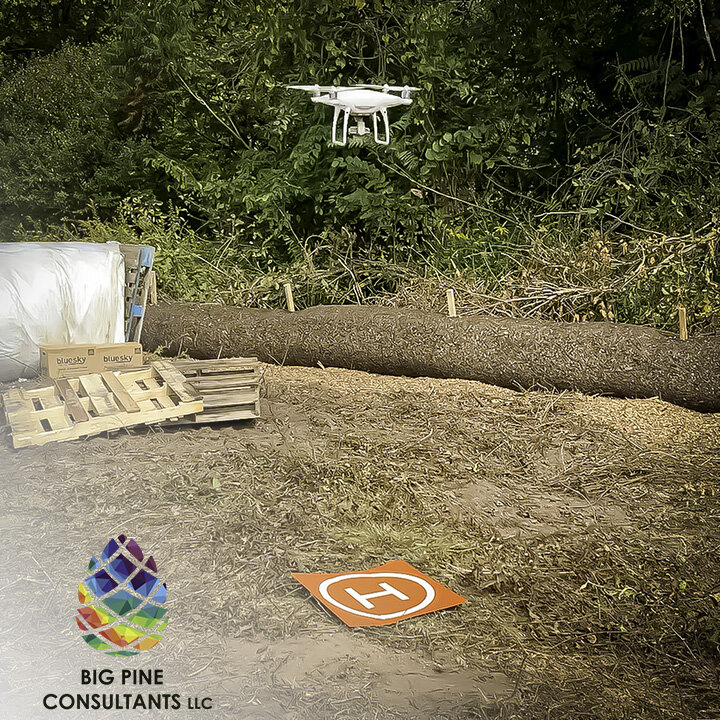
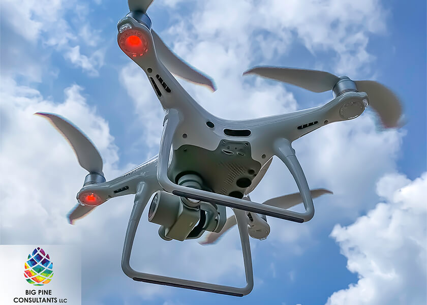
At Big Pine, we currently use a DJI Phantom 4 Pro V2.0 drone for our work. It is rated for a flight time of 31 minutes, however real world flights rarely can last that long. A typical flight time is about 25 minutes. At 250 feet altitude, with 80/80 overlap of images, the October 21, 2020 flight in the 3D model above required 17 minutes to fly and covered approximately 22 acres. If need be, Big Pine has extra batteries and multiple flights can be combined to cover larger areas. Depending on flight altitude and winds, Big Pine estimates we can fly areas of about 40-60 acres in a single day including setting GCPs. For linear Projects, we can typically fly lengths of about 1-2 miles in a single day depending on flight altitude, winds, and availability of locations with good line-of-sight distance from the remote pilot to the drone.
Post-Processing
At this point, we had our GCP locations and imagery. The next step was to put it all together into useful products for our clients. If they just wanted photographs and video, the task could have been completed simply by sending them the raw images and video from the drone. A lot of people have that ability. They great for qualitative progress updates to management, but are not as useful for things like understanding how much earth still needs to be moved, what the topography looks like currently, or future planning and design work. For that, we need to process the images with the GCP locations to produce photogrammetry products. Big Pine has used different products and there are unique capabilities and use cases for each. They typically all produce a standard suite of products including:
- Orthomosaic imagery for mapping
- Digital Elevation Model (DEM) raster
- Digital Terrain Model (DTM) raster
- Contours
- Hillshade raster
- 3D Mesh (various file types)
- 3D Point Cloud (.las)
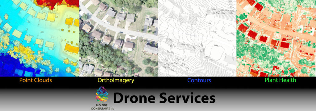
These products are all produced using photogrammetry, which is fundamentally different from LiDAR. Photogrammetry extracts three-dimensional measurements from two-dimensional data (i.e. images). The distance between two points that lie on a plane parallel to the photographic image plane can be determined by measuring their distance on the image, if the scale of the image is known. Photogrammetry software uses various algorithms to stitch the imagery into the 2D and 3D products listed above. Having been processed using photogrammetry, the 3D data has limitations, the main one being that the elevations are less useful in areas of tree cover. LiDAR is better able to penetrate forest canopy and distinguish ground from trees. This can be done to a very limited extent with data produced photogrammetrically using ESRI ArcGIS Pro to analyze the resulting point cloud product, however the results are not typically reliable. Elevations obtained using photogrammetry with our current drone is therefore limited to generally open areas.
The biggest difference that we have identified for photogrammetry software has been where the processing takes place and the timeframe to process the images into products. There are 2 main types of software, “cloud based” and “local”. The vast majority of software is cloud based including:
- Pix4D
- Drone Deploy
- Site Scan
- Dronemapper
- AutoDesk ReCap
- PrecisionHawk 3D
- and numerous others
Some of the cloud solutions require you to use their own associated flight planning software. Some have limited support for specific drone platforms. Some require additional software to provide the expected functionality. They have different costs and methods for monetization, such as subscription lengths and addons like charging to process ground control points with the imagery (instead of relying on the drone’s own GPS only). Most of them ultimately use the Pix4D engine to process the imagery, so the results are often similar. They all process the images by first uploading them to the cloud, if necessary linking the GCPs to the images, and then waiting for the server to process the images and send you an email to download the products. The cloud based solution does not require you to own a fast computer, but it does rely on uploading and downloading a lot of large files. So you need to have a high-speed and reliable internet connection, which is usually not available in the field. As a result, you must bring the imagery back to the office and process it, which may take more time.
At Big Pine we use a local solution called Drone2Map. Drone2Map is an ESRI product that looks and feels similar to ArcGIS Pro. The products work well together even though they are separate programs (rather than Drone2Map being an extension of ArcGIS Pro). Similar to most of the cloud based solutions, it uses the Pix4D engine for processing. As a local program, we run Drone2Map on a high powered laptop with an extremely fast, dedicated Graphics Processing Unit (GPU) to process the imagery quickly. The main benefit of Drone2Map is the ability to run it without a highspeed internet connection. It can even be run in the field with no connection at all to verify that all of the required images were collected before heading back from the field. This reduces the amount of time it takes create the 2D and 3D deliverables.
How Fast Can You Get Products?
To give you an idea of how fast this can be done, each of the flights in the 3D models above were flown in about 6 hours including drive time (1 hour each way), setting GCPs, flight planning, and completing the flight (covered about 22 acres). We did the processing in the office and it took about 4 hours to process the images into most of the 2D and 3D products above. We then spent another 2 hours to create maps and web scenes in ArcGIS Pro.
If needed, we can often complete fieldwork, processing, and GIS mapping for a typical site NEXT DAY!
For the web based 3D models above, we uploaded our scenes to our ArcGIS online organization site and created a web app to display the two side by side. I am writing this text on October 27, 2020, the day after configuring the web app. We were able to produce and publish that model in under one week.
What is the Resolution of the Images?
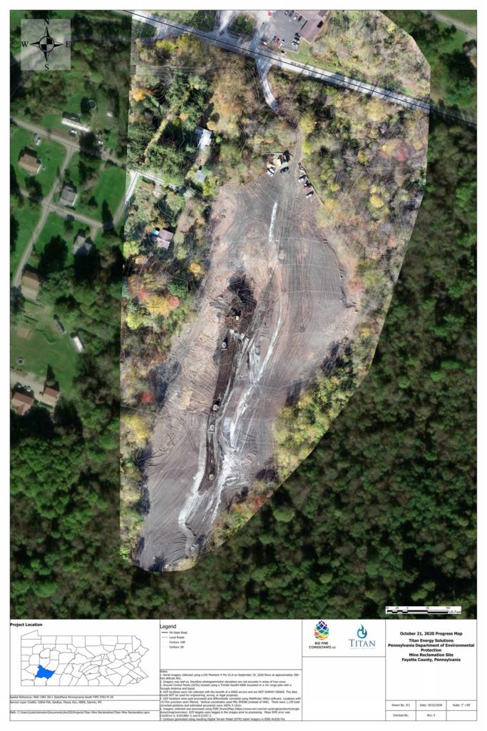
The best way to show you the resolution of the orthomosaic is to show you an example map that has both the publicly available imagery and the drone imagery so you can see it for yourself. Click on the map below for a high resolution PDF.
What Analysis Can I Do?
This creates an alternative to publicly available LiDAR elevation data and orthomosaic imagery that is:
- safe,
- high resolution,
- shows current conditions,
- can be obtained quickly (often in a few days), and
- is affordable.
Once all of the data is processed, you can do a lot with the information. You can load the 3D mesh into Autodesk products like Civil3D to complete engineering analyses and designs such as determining cut/fill volumes and slopes*. You can load the products into ESRI products such as ArcGIS Pro to create maps, 3D scenes, and do all of the analyses that ArcGIS can do.
It can be used to document current conditions, progress of a construction project, or to show that vegetation coverage has been achieved to close out your NPDES permit. It can be used to get topographic information for hard to reach places or places that are dangerous for people to collect on foot. In the example of above, earth moving activities did not need to stop because the only on-foot activities of setting GCPs only required access around the periphery of the site.
A list of some uses are below:
- Photos and video for marketing real estate
- 3D Models, point clouds, and 3D mesh for Civil 3D and other CAD software
- Contour mapping
- ESRI Online Web Applications including 2D mapping or 3D scenes
- Construction progress videos or mapping
- Basemap imagery to show current conditions for your project
- Document current vegetative cover to close out an NPDES permit
- Inspect a utility right-of-way for disturbances
- Collect video or mapping of current conditions for Project planning or bid
- Production videography and photography for creative projects or public outreach
- Other uses you may come up with!
Additional sensors can be used to obtain other forms of data in addition to photogrammetry. For instance, thermal sensors can be used for things like leak detection. LiDAR sensors are available for some drone platforms, but can be expensive. Multispectral sensors can be used to determine plant health for agricultural purposes. Big Pine can rent units to address specific needs of our clients, so if you have a use case you would like to discuss, please reach out to Justin Johnston.
